
DCFR Insight 36 / Title + Survey + Land Rights
Land DevelopmentData Center Title, Survey, Easement, and Legal Access Due Diligence
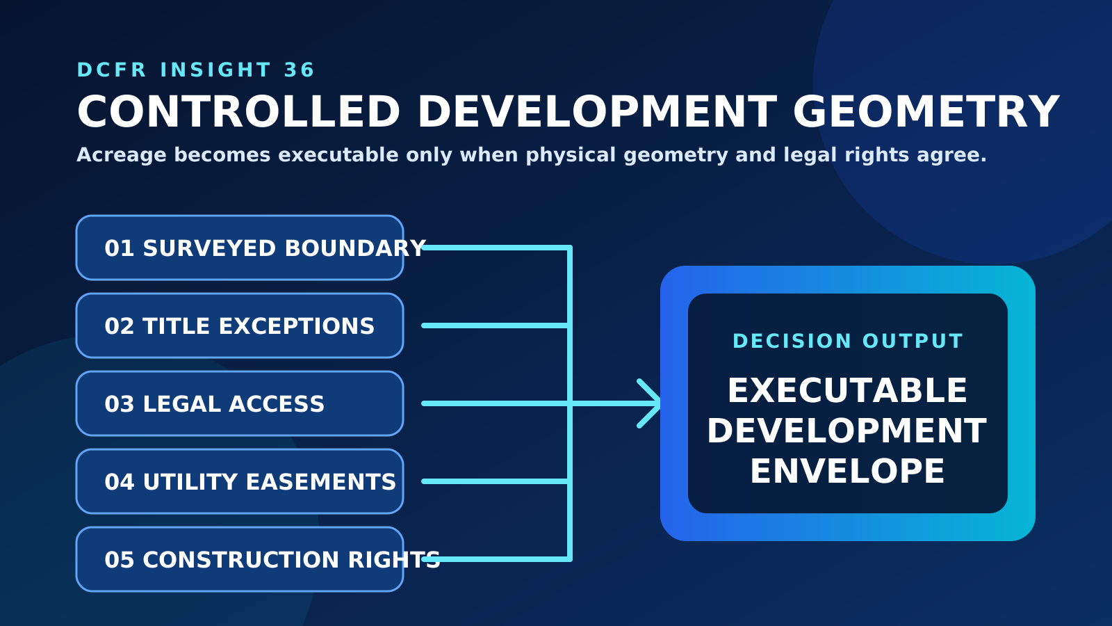
A parcel is not development-ready until its boundary, title exceptions, access, utility corridors, construction rights, encroachments, and future-phase land rights support the campus that must actually be built and operated.

Marketed acreage is not controlled development geometry
A listing, tax map, or conceptual boundary does not prove that the project controls the land needed for buildings, substations, roads, stormwater, buffers, temporary construction, utility routes, maintenance, replacement, and expansion. Establish the legal parcel, surveyed boundary, ownership interests, adjoining relationships, and every right the ultimate campus depends on. The acquisition question is not whether the seller owns a large tract. It is whether the project can legally use a coordinated three-dimensional envelope for its full development sequence.
Use the governing survey and title basis for the jurisdiction
For U.S. transactions that adopt an ALTA/NSPS Land Title Survey, the 2026 Minimum Standard Detail Requirements became effective February 23, 2026 and superseded prior versions. That standard is not a universal substitute for applicable cadastral, land-registration, boundary, survey, or title requirements. In every jurisdiction, scope the work with the appropriately licensed surveyor, registry or title professional, lender, counsel, and technical team; select optional items deliberately; confirm off-site interests and certification or reliance requirements; and set the date by which field and land-right evidence must support the decision.
Reconcile the survey and title commitment line by line
The survey shows physical evidence and mapped relationships; the title work identifies the recorded interests, exceptions, requirements, and documents affecting the estate. They must be read together. Plot every locatable exception, identify documents that cannot be plotted, resolve discrepancies in legal descriptions, and assign review of restrictions, covenants, access rights, mineral or subsurface interests, leases, options, liens, encroachments, gaps, overlaps, and unrecorded evidence. A clean-looking plan can still carry a title provision that limits use, height, utilities, access, subdivision, or assignment.
Prove legal and physical access for every operating condition
Legal access and a paved connection are different facts. Confirm the estate or easement that authorizes access, the exact connection to a public right-of-way, permitted users and vehicles, width, geometry, grade, turning, weight and clearance limits, gate control, emergency access, construction traffic, heavy-haul and equipment-replacement routes, maintenance, snow or debris responsibility, and future widening. Test whether the route remains usable during phased construction and whether a secondary or emergency connection depends on a revocable permission or third-party parcel.
Translate every utility line into an executable land right
Power, substation tie-ins, water, sewer, fiber, fuel, drainage, outfalls, and temporary services may cross land the buyer does not own. A concept alignment is only a hypothesis. For each route, define the surveyed corridor, rights holder, benefited and burdened parcels, permitted facilities and capacity, construction and laydown access, vegetation and clearance control, inspection, maintenance, repair, replacement, relocation, restoration, priority, exclusivity, duration, assignability, lender acceptance, and treatment of future phases. Engineering should confirm the right supports the actual asset before counsel finalizes the instrument.
Land-Rights Execution Matrix
| Required right | Minimum evidence | Technical acceptance test | Commercial or closing control |
|---|---|---|---|
| Primary and emergency access | Surveyed connection, recorded right and public-road interface | Vehicles, fire apparatus, construction and replacement routes work by phase | Accepted easement or dedication; cure, extension or termination right |
| Power and substation route | Surveyed corridor, title review and executable instrument | Voltage, structures, clearances, access, construction and future capacity fit | Recordable and assignable right before dependent funding |
| Water, sewer and fiber | Route, provider interface, easement terms and crossing consents | Size, depth, separation, maintenance and redundant-route needs fit | Closing deliverable, seller cooperation and third-party consent |
| Stormwater and outfall | Drainage path, downstream rights and maintenance access | Discharge, grading, environmental and long-term maintenance needs fit | Permanent and temporary rights with recorded maintenance duties |
| Temporary construction | Defined work area, term, access, permitted activity and restoration | Laydown, cranes, grading, installation and phasing can occur safely | Diligence or construction access covenant with extension and remedy |
| Future expansion | Rights sized and drafted for ultimate campus and successors | Additional circuits, roads, pipes, replacement and shared use remain feasible | Survival, assignability, expansion rights and non-interference protection |
Planning-grade coordination only. Licensed surveyors, title professionals, qualified counsel, lenders, authorities, utilities, and project engineers should confirm project-specific requirements and instruments.
Separate permanent, temporary, and future-phase rights
The finished campus may fit while construction cannot. Identify temporary construction easements, crane and overswing needs, grading and slope rights, tieback or shoring interfaces, haul routes, borrow or disposal access, utility installation zones, dewatering discharge, environmental mitigation access, staging, and restoration. Then identify future-phase rights that must survive closing and initial construction. A right adequate for Phase 1 can become a stranded-capacity problem if it cannot be expanded, shared, assigned, or used for replacement work.
Map encumbrances against the campus—not beside it
Overlay title exceptions and surveyed evidence on the same controlled base used for site fit. Test overhead and underground utilities, pipelines, drainage ways, rail or roadway rights, conservation areas, cemeteries, access rights, setback instruments, leases, encroachments, and third-party maintenance zones against buildings, yards, security, grading, stormwater, fire access, and expansion. Record whether each item is compatible, avoidable, relocatable, curable, insurable, priceable, or fatal. Narrative title comments without spatial coordination do not establish usable acreage.
Control curative actions through objective closing evidence
For every unacceptable exception or missing right, define the required action, responsible party, document, technical acceptance, execution and recordation sequence, third-party consent, lender or title approval, deadline, cost, and remedy. Examples include releases, subordinations, boundary-line agreements, access easements, utility easements, joinders, consents, relocations, parcel combinations, subdivisions, and updated endorsements. Tie commercial exposure to evidence that the action is complete—not to an informal promise that it will be handled later.
Create one land-rights confirmation register
The register should connect each required right to the parcel and phase it serves, the relevant survey feature and title document, its technical criteria, current evidence, gap, curative action, owner, dependency, target date, closing condition, and residual risk. Review it jointly with survey, title, counsel, civil, utility, environmental, real-estate, design, construction, finance, and operations leads. When a route or master plan changes, the register should expose every right, document, study, and commercial term that must change with it.
Title-and-Survey Issue Disposition
| Disposition | Meaning | Required record | Decision effect |
|---|---|---|---|
| Compatible | The interest can remain without impairing the approved campus basis | Mapped condition and written discipline acceptance | Carry as a controlled constraint |
| Avoid | The campus or route can move without unacceptable loss | Revised coordinated plan and affected-study review | Update capacity, cost and schedule |
| Cure | A release, correction, consent, relocation or new right is required | Executed or recordable document and technical acceptance | Make a condition or priced milestone |
| Insure or accept | The residual legal exposure is knowingly retained | Counsel, title, lender and investment approval | State retained risk and decision authority |
| Fatal or repricing | The issue materially defeats capacity, access, schedule or financeability | Decision paper with alternatives and quantified effect | Reject, reprice, restructure or extend |
Make a land decision—not a document-completion decision
The final recommendation should state whether the site has a legally and physically executable development envelope, which rights remain unresolved, how those gaps affect capacity, schedule, cost, financing, construction, and operations, and which commercial protections contain the uncertainty. The appropriate outcome may be advance, advance with conditions, redesign, cure, reprice, extend, or reject. A completed survey and title package are inputs; they are not proof that the campus can be delivered.
Current Technical Basis — August 2026
American Land Title Association and National Society of Professional Surveyors
2026 Minimum Standard Detail Requirements for ALTA/NSPS Land Title SurveysOfficial U.S. source for the standards effective February 23, 2026, related forms, and implementation materials; other jurisdictions require their own governing survey and land-registration basis.
American Land Title Association
2026 ALTA/NSPS Land Title Survey Standards — Key UpdatesOfficial overview of the 2026 standards that replaced the 2021 version.
Loudoun County, Virginia
Data Center Standards and LocationsOfficial example of jurisdiction-specific data-center standards that should be reconciled with legal parcel and easement geometry.
Technical basis reviewed August 2026. Cooling technology, equipment capability, vendor qualification, and industry guidance continue to evolve; project decisions should use the latest applicable manufacturer data and professional engineering analysis.
Capacity-delivery review checklist
What to verify before the next release gate.
- The legal parcel, surveyed boundary, ownership interests, and adjoining relationships use one current base
- The survey scope uses the applicable 2026 ALTA/NSPS standard and deliberately selected Table A items
- Every locatable title exception is plotted and every unplottable exception has an assigned review
- Primary, emergency, construction, heavy-haul, and replacement access are legally and physically proven
- Every utility and outfall route has technically sufficient, recordable, assignable land rights
- Temporary construction and future-phase rights are separated from permanent Phase 1 rights
- Encumbrances are overlaid against buildings, yards, grading, drainage, security, fire access, and expansion
- Curative actions have objective documents, owners, dates, acceptance criteria, cost, and remedies
- Route or master-plan changes trigger survey, title, easement, study, schedule, and commercial updates
- The acquisition recommendation states residual land-rights exposure and its capacity, cost, and schedule effect
What DCFR would flag
Delivery risks that should be visible early.
A line on a site plan is not a controlled right. DCFR would flag any access, utility, outfall, construction, maintenance, replacement, or expansion dependency that is not reconciled across survey, title, engineering, and transaction documents.
Professional confirmation required
Items requiring project-specific validation.
Confirm the governing land-registration and survey system, boundaries, title or ownership evidence, legal descriptions, exceptions, access, easements or equivalent rights, recordability, assignability, endorsements, curative documents, and enforceability with appropriately licensed surveyors, registry or title professionals, qualified counsel, lenders, authorities, utilities, and technical consultants.
Final takeaway
Development-ready land is a coordinated bundle of geometry and rights—not simply acreage under contract.
Surface site, code, utility, and delivery risk before it becomes expensive.
DCFR converts early assumptions into planning-grade flags, confirmation registers, and decision-ready feasibility outputs.