
DCFR Insight 71 / Land Development · Gross-to-Net Land Yield
How Much Land Does a Data Center Campus Actually Need?
Gross acreage is a poor proxy for data center capacity. The real question is how much controlled land remains after setbacks, buffers, utilities, stormwater, grading, roads, power yards, security, and future phases are accounted for.
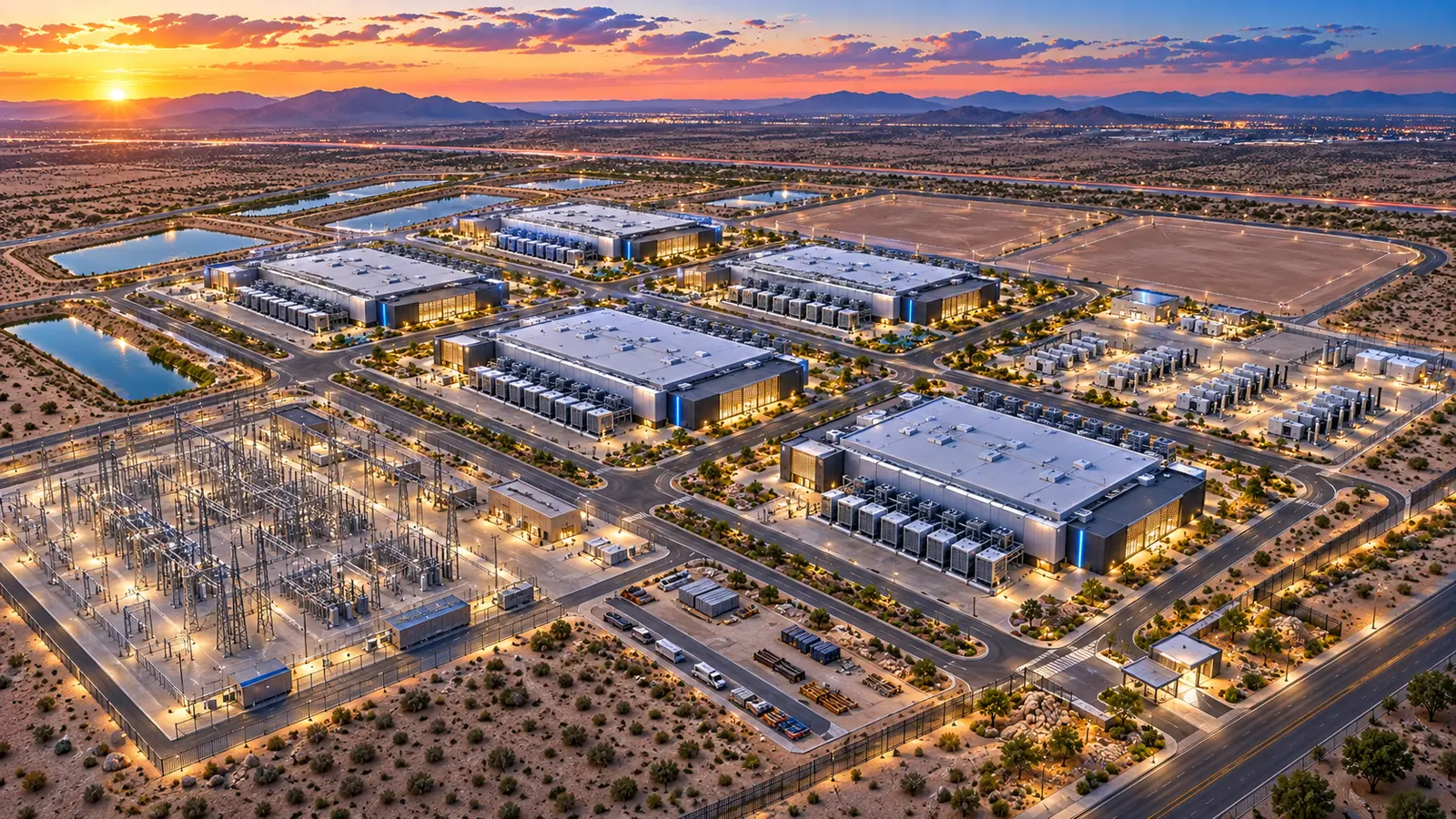
Start with required capacity and operating model
The starting point is not whether the parcel looks attractive. Define the business outcome the land must support and the evidence required to prove it. For this topic, the controlling inputs include target IT and utility capacity, building and yard prototypes, and setbacks, buffers and screening. State assumptions explicitly so an early concept cannot quietly become a committed basis without validation.
Convert gross acreage into a constraint map
Build the evidence on one controlled site and schedule basis. Reconcile target IT and utility capacity, building and yard prototypes, setbacks, buffers and screening, substations, switchyards and utility corridors, stormwater and environmental areas, and roads, parking, security and construction logistics rather than allowing each discipline to work from a different boundary, phasing assumption, utility date, or campus concept. When evidence is preliminary, label its confidence level and identify the party responsible for confirmation.

Reserve infrastructure before placing buildings
A practical workflow is to set capacity and phasing assumptions; then map non-buildable and conditionally usable areas; then reserve power and utility zones; then lay out buildings and operational yards; then test grading, fire access and construction sequencing; then calculate net developable acreage and expansion reserve. The sequence is intentionally decision-led: each activity should either confirm feasibility, expose a dependency, quantify an impact, create a mitigation, or support a commercial or investment gate.
Development Control Matrix
| Control question | Evidence required | If unresolved | Decision effect |
|---|---|---|---|
| What must be true? | target IT and utility capacity + building and yard prototypes | Assign owner and confirmation date | Do not treat as confirmed |
| What controls timing? | test grading, fire access and construction sequencing + calculate net developable acreage and expansion reserve | Build downside scenario | Adjust capacity date or commercial milestone |
| What can defeat the site? | counting constrained acreage as usable + placing buildings before substations and corridors | Mitigate, redesign, reprice, or exit | Escalate to investment gate |
| What can be traded? | density versus operational resilience + compactness versus construction flexibility | Compare alternatives on one basis | Choose risk-adjusted outcome |
Planning-grade framework. Applicable law, utility rules, entitlement procedures, engineering criteria, transaction terms, and licensed-professional requirements vary by jurisdiction and project.
Protect circulation, safety, and service geometry
The highest-consequence failure modes include counting constrained acreage as usable, placing buildings before substations and corridors, under-sizing stormwater or buffers, future phases blocked by Phase 1 infrastructure, and service or emergency access that works only on a static plan. Separate these from ordinary design development. A red flag belongs in the executive risk register when it can materially change deliverable capacity, approval probability, schedule, capital exposure, operations, or the ability to exit the transaction.

Test phasing and future expansion on the same plan
Real sites rarely optimize every variable at once. Typical trade-offs include density versus operational resilience, compactness versus construction flexibility, more buildings versus larger infrastructure reserves, and near-term yield versus long-term expansion. Compare alternatives against the same capacity, date, cost, and risk basis. A mitigation that solves one discipline but creates a larger entitlement, utility, construction, or operating problem is not a complete solution.

Report net usable capacity, not acreage alone
Use gross-to-net land yield tied to a tested campus concept and capacity assumptions; never make an acquisition decision from acreage alone. Record the decision, assumptions, unresolved confirmations, owner, target date, and trigger for reconsideration. That record becomes the bridge between diligence, transaction documents, entitlement, design, infrastructure delivery, construction, and future portfolio learning.
Early screening checklist
What to verify before advancing this site.
- The decision objective for Series Part 03 is explicit
- Target IT and utility capacity is supported by current evidence
- Building and yard prototypes is supported by current evidence
- Setbacks, buffers and screening is supported by current evidence
- Substations, switchyards and utility corridors is supported by current evidence
- Cross-discipline assumptions use one controlled plan and phasing basis
- Material red flags have an owner, mitigation, cost and schedule effect
- Commercial milestones do not outrun technical and entitlement evidence
- The recommendation states what would cause the decision to change
What DCFR would flag
Risks surfaced at the screening stage.
DCFR would flag any site decision where counting constrained acreage as usable, placing buildings before substations and corridors, under-sizing stormwater or buffers are still being treated as background assumptions rather than controlled development risks with evidence, ownership, and a decision path.
Professional confirmation required
Items requiring licensed validation.
Confirm project-specific land rights, zoning and entitlement requirements, utility capacity and agreements, environmental jurisdiction, civil and geotechnical criteria, life-safety requirements, infrastructure obligations, costs, schedules, and transaction terms with the applicable authorities, utilities, qualified counsel, and appropriately licensed design and technical professionals.
Final takeaway
Use gross-to-net land yield tied to a tested campus concept and capacity assumptions; never make an acquisition decision from acreage alone.
Screen up to 20 candidate sites before selecting one for the full DCFR report.
Each DCFR Report Package includes a preliminary 20-site comparison PDF / export package plus one selected planning-grade feasibility report.